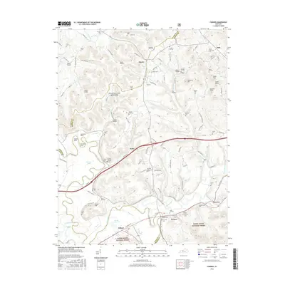
2016 Map of Farmers
USGS Topo · Published 2016About this map
The Licking River winds through this landscape, carving distinct features like Ingram Bend, Muleshoe Bend, and Horseshoe Bend as it flows near the community of Farmers. This area of eastern Kentucky, situated where the Daniel Boone National Forest meets the valley, is characterized by a dense network of cemeteries that serve as vital records for family historians. From the Woodford Black Cem and Johnson Black Cem to family-named sites like Swim Family Cem and Craycraft Cem, the map documents a deeply rooted rural community. The presence of the Morehead-Rowan County Clyde A Thomas Regional Airport highlights the transition from traditional river-valley life to modern transportation infrastructure, while water bodies like Spring Grove Lakes and Snedegar Pond punctuate the bottomlands near Midland.
Find a feature on this map
142 named features on this map. Tap any name to fly to it.
Don’t see what you’re looking for? This feature index may not catch every label — zoom into the map to look around manually.
Map Details
Editions of this 2016 Farmers Map
This is the sole edition of this map. No revisions or reprints were ever made.
Other maps of this area

1929 · Morehead
USGS Topo · 1:48,000

1929 · Salt Lick
USGS Topo · 1:62,500

1934 · Salt Lick
USGS Topo · 1:62,500

1935 · Morehead
USGS Topo · 1:62,500

1951 · Cranston
USGS Topo · 1:24,000

1951 · Hillsboro
USGS Topo · 1:24,000

1951 · Plummers Landing
USGS Topo · 1:24,000

1953 · Olympia
USGS Topo · 1:24,000

1953 · Farmers
USGS Topo · 1:24,000

1953 · Bangor
USGS Topo · 1:24,000