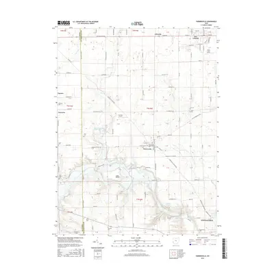
2016 Map of Farmersville
USGS Topo · Published 2016About this map
Farmersville and the surrounding townships sit along the western edge of Montgomery County, where the terrain begins to transition toward the Preble County line. The landscape is defined by the winding course of Twin Creek and its many tributaries, including Toms Run and Little Twin Creek. In the southern portion of the area, the Germantown Reservoir and Sunfish Pond highlight the local water management and recreation infrastructure of the mid-2010s.
Find a feature on this map
144 named features on this map. Tap any name to fly to it.
Don’t see what you’re looking for? This feature index may not catch every label — zoom into the map to look around manually.
Map Details
Editions of this 2016 Farmersville Map
This is the sole edition of this map. No revisions or reprints were ever made.
Other maps of this area

1905 · Brookville
USGS Topo · 1:62,500

1908 · Miamisburg
USGS Topo · 1:62,500

1911 · Oxford
USGS Topo · 1:62,500

1951 · Franklin
USGS Topo · 1:24,000

1953 · Cincinnati
USGS Topo · 1:250,000

1955 · Miamisburg
USGS Topo · 1:24,000
1955 · Trotwood
USGS Topo · 1:24,000

1957 · Cincinnati
USGS Topo · 1:250,000
1959 · Middletown
USGS Topo · 1:24,000

1960 · Farmersville
USGS Topo · 1:24,000