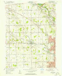
1955 Map of Trotwood
USGS Topo · Published 1956About this map
Trotwood and its neighboring rural townships are captured in this mid-1950s survey, showing a landscape defined by small crossroad settlements and a developing transportation grid. The path of the Pennsylvania railroad cuts across the terrain, linking communities like Hays Corner and Fort McKinley to the larger urban sprawl of Dayton emerging in the southeast. Along the Stillwater River, the Miami Conservancy District preserves land near Englewood, while scattered institutions like the Stillwater Sanitarium and Dahio Airfield reflect the era's regional infrastructure.
Find a feature on this map
66 named features on this map. Tap any name to fly to it.
Don’t see what you’re looking for? This feature index may not catch every label — zoom into the map to look around manually.
Map Details
Editions of this 1955 Trotwood Map
This is the sole edition of this map. No revisions or reprints were ever made.
Other maps of this area

1904 · Dayton
USGS Topo · 1:62,500

1905 · Brookville
USGS Topo · 1:62,500

1906 · Dayton
USGS Topo · 1:62,500

1908 · Miamisburg
USGS Topo · 1:62,500

1913 · Waynesville
USGS Topo · 1:62,500

1915 · Waynesville
USGS Topo · 1:62,500

1953 · Cincinnati
USGS Topo · 1:250,000

1955 · Miamisburg
USGS Topo · 1:24,000

1955 · Dayton South
USGS Topo · 1:24,000

1955 · West Milton
USGS Topo · 1:24,000