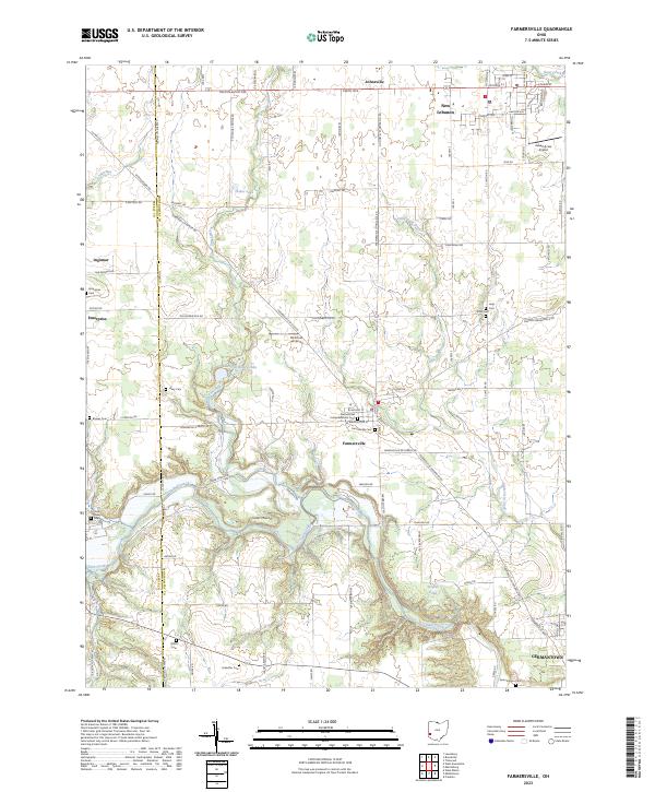
2023 Map of Farmersville
USGS Topo · Published 2023About this map
Farmersville and the surrounding township lands in western Montgomery County are defined by the winding course of Twin Creek and its many tributaries. This modern survey illustrates a landscape deeply rooted in its agricultural and community history, evidenced by the high density of family and congregational burial grounds such as Dutch Cem, Schaeffer Cem, and United Brethren Cem. The terrain south of the village is marked by the distinct elevation of Cedar Mound, while the rural outskirts are punctuated by private aviation sites like McIntosh Airport.
Find a feature on this map
73 named features on this map. Tap any name to fly to it.
Don’t see what you’re looking for? This feature index may not catch every label — zoom into the map to look around manually.
Map Details
Editions of this 2023 Farmersville Map
This is the sole edition of this map. No revisions or reprints were ever made.
Other maps of this area

1905 · Brookville
USGS Topo · 1:62,500

1908 · Miamisburg
USGS Topo · 1:62,500

1911 · Oxford
USGS Topo · 1:62,500

1951 · Franklin
USGS Topo · 1:24,000

1953 · Cincinnati
USGS Topo · 1:250,000

1955 · Miamisburg
USGS Topo · 1:24,000
1955 · Trotwood
USGS Topo · 1:24,000

1957 · Cincinnati
USGS Topo · 1:250,000
1959 · Middletown
USGS Topo · 1:24,000

1960 · Farmersville
USGS Topo · 1:24,000