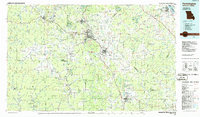
1986 Map of Farmington
USGS Topo · Published 1986About this map
The Lead Belt of the St. Francois Mountains region is shown here during a period of transition in the late 20th century. Large industrial and mining footprints are evident near Leadwood, Desloge, and Flat River, reflecting the legacy of mineral extraction that shaped these Ozark communities. The Missouri Pacific RR connects these major hubs, while the landscape south of Farmington gives way to significant public lands and geological landmarks.
Find a feature on this map
127 named features on this map. Tap any name to fly to it.
Don’t see what you’re looking for? This feature index may not catch every label — zoom into the map to look around manually.
Map Details
Editions of this 1986 Farmington Map
This is the sole edition of this map. No revisions or reprints were ever made.
Other maps of this area

1901 · De Soto
USGS Topo · 1:125,000

1903 · Sullivan
USGS Topo · 1:125,000

1904 · Farmington
USGS Topo · 1:62,500

1905 · Bonneterre
USGS Topo · 1:62,500

1906 · Potosi
USGS Topo · 1:62,500

1906 · Farmington
USGS Topo · 1:62,500

1907 · Weingarten
USGS Topo · 1:62,500

1909 · Weingarten
USGS Topo · 1:62,500

1910 · Higdon
USGS Topo · 1:62,500

1912 · Baldwin
USGS Topo · 1:62,500