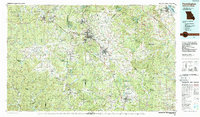
1987 Map of Farmington
USGS Topo · Published 1987About this map
The St Francois Mountains dominate this 1980s landscape, featuring the highest point in the state at Taum Sauk Mountain. This region, deeply shaped by its geology, displays a unique pattern of industrial and recreational land use. Historic mining operations like the Iron Mountain Mine and Mine La Motte are visible alongside the sprawling tailing ponds and reclamation areas that now form St Joe State Park. The map documents the lead belt's transition, where settlements such as Bonne Terre, Leadwood, and Flat River sit adjacent to newer planned communities like Terre Du Lac. Transportation is anchored by the Missouri Pacific railroad and a network of highways including Us 67 and Missouri 21, connecting these industrial hubs to the rugged interior of the Mark Twain National Forest and specialized preserves like Elephant Rocks State Park and the Bell Mountain Wilderness.
Find a feature on this map
104 named features on this map. Tap any name to fly to it.
Don’t see what you’re looking for? This feature index may not catch every label — zoom into the map to look around manually.
Map Details
Editions of this 1987 Farmington Map
This is the sole edition of this map. No revisions or reprints were ever made.
Other maps of this area

1901 · De Soto
USGS Topo · 1:125,000

1903 · Sullivan
USGS Topo · 1:125,000

1904 · Farmington
USGS Topo · 1:62,500

1905 · Bonneterre
USGS Topo · 1:62,500

1906 · Potosi
USGS Topo · 1:62,500

1906 · Farmington
USGS Topo · 1:62,500

1907 · Weingarten
USGS Topo · 1:62,500

1909 · Weingarten
USGS Topo · 1:62,500

1910 · Higdon
USGS Topo · 1:62,500

1912 · Baldwin
USGS Topo · 1:62,500