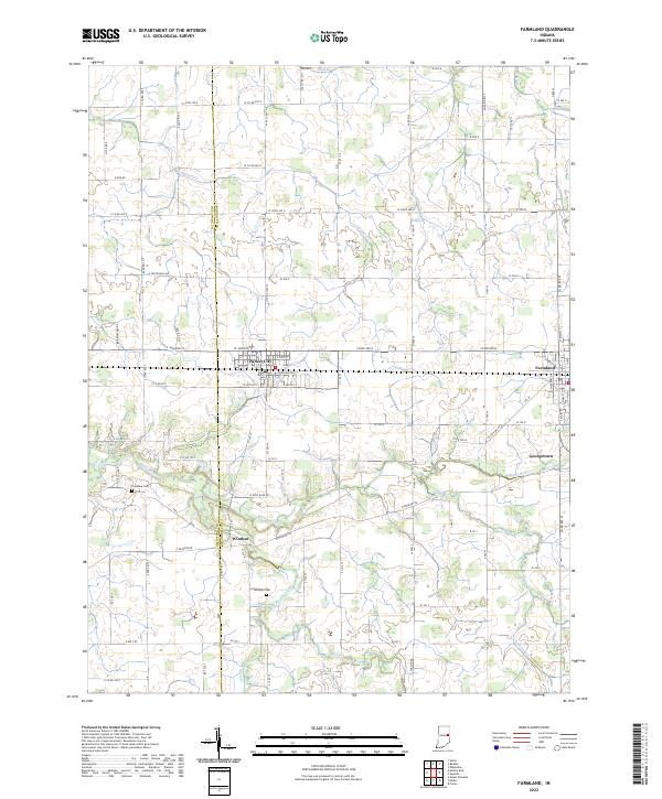
2022 Map of Farmland
USGS Topo · Published 2022About this map
The White River and its various tributaries, including Little White River and Stoney Creek, define the agricultural landscape of this section of East Central Indiana. Situated along the boundary of Delaware and Randolph Counties, the area is characterized by a dense grid of rural roads and established settlements. Parker City and Farmland serve as primary hubs along the northern corridor, while smaller communities like Windsor and Georgetown are positioned near the riverbanks to the south. Local history is anchored by sites such as Swingley Cem and Freidline Cem, which provide specific points of interest for genealogists tracing family roots in these townships. The drainage patterns, represented by features like Cabin Cr and Lamb Ditch, illustrate the sophisticated water management essential to the region's farming heritage.
Find a feature on this map
98 named features on this map. Tap any name to fly to it.
Don’t see what you’re looking for? This feature index may not catch every label — zoom into the map to look around manually.
Map Details
Editions of this 2022 Farmland Map
This is the sole edition of this map. No revisions or reprints were ever made.
Other maps of this area

1952 · Maxville
USGS Topo · 1:24,000

1952 · Muncie East
USGS Topo · 1:24,000

1952 · Farmland
USGS Topo · 1:24,000

1953 · Muncie
USGS Topo · 1:250,000

1956 · Muncie
USGS Topo · 1:250,000

1960 · Eaton
USGS Topo · 1:24,000

1960 · Mount Pleasant
USGS Topo · 1:24,000

1960 · Carlos
USGS Topo · 1:24,000

1960 · Ridgeville
USGS Topo · 1:24,000
1960 · Modoc
USGS Topo · 1:24,000