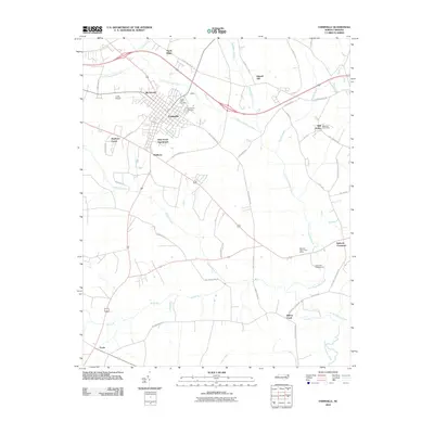
2010 Map of Farmville
USGS Topo · Published 2010About this map
Farmville serves as the central hub of this Eastern North Carolina landscape, where the town's residential expansion is evident through developments like Birchwood and Pine Grove Apartments. The surrounding Pitt County countryside is defined by a intricate network of drainage, primarily the winding Little Contentnea Creek and its many tributaries including Olduoman Branch and Pinelog Branch. These waterways historically dictated the placement of early settlements and road crossings, many of which remain visible as established communities.
Find a feature on this map
47 named features on this map. Tap any name to fly to it.
Don’t see what you’re looking for? This feature index may not catch every label — zoom into the map to look around manually.
Map Details
Editions of this 2010 Farmville Map
This is the sole edition of this map. No revisions or reprints were ever made.
Other maps of this area

1902 · Ayden
USGS Topo · 1:62,500

1903 · Winterville
USGS Topo · 1:62,500

1904 · Ayden
USGS Topo · 1:62,500

1904 · Falkland
USGS Topo · 1:62,500

1905 · Winterville
USGS Topo · 1:62,500

1914 · Kinston
USGS Topo · 1:48,000

1916 · Kinston
USGS Topo · 1:62,500

1953 · Rocky Mount
USGS Topo · 1:250,000

1954 · Rocky Mount
USGS Topo · 1:250,000

1980 · Falkland
USGS Topo · 1:24,000