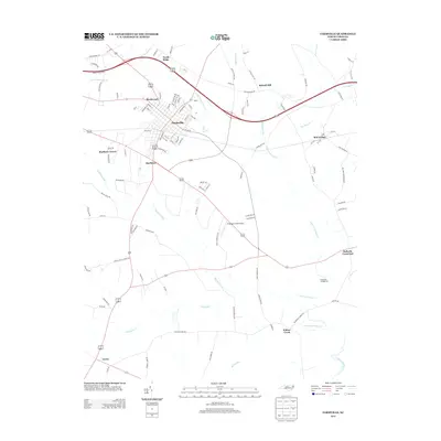
2013 Map of Farmville
USGS Topo · Published 2013About this map
Farmville serves as the central hub of this eastern North Carolina landscape, where a dense network of residential streets like Church St and Evans Dr meet regional thoroughfares. The town is situated just south of the winding Little Contentnea Cr, a waterway that defines the local drainage alongside several significant marshy features including Middle Swamp and Sandy Run. This survey captures the transition from the concentrated core of Farmville to outlying residential developments such as North Ridge, Birchwood, and Marlboro Forest.
Find a feature on this map
102 named features on this map. Tap any name to fly to it.
Don’t see what you’re looking for? This feature index may not catch every label — zoom into the map to look around manually.
Map Details
Editions of this 2013 Farmville Map
This is the sole edition of this map. No revisions or reprints were ever made.
Other maps of this area

1902 · Ayden
USGS Topo · 1:62,500

1903 · Winterville
USGS Topo · 1:62,500

1904 · Ayden
USGS Topo · 1:62,500

1904 · Falkland
USGS Topo · 1:62,500

1905 · Winterville
USGS Topo · 1:62,500

1914 · Kinston
USGS Topo · 1:48,000

1916 · Kinston
USGS Topo · 1:62,500

1953 · Rocky Mount
USGS Topo · 1:250,000

1954 · Rocky Mount
USGS Topo · 1:250,000

1980 · Falkland
USGS Topo · 1:24,000