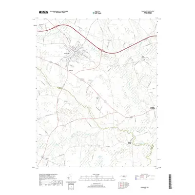
2019 Map of Farmville
USGS Topo · Published 2019About this map
Farmville serves as the primary hub of this eastern North Carolina landscape, where the town’s grid is anchored by Hollywood Cem and Forest Hills Cem. The surrounding terrain transitions from the developed streets of the town center into the agricultural and swampy lowlands of the Coastal Plain. Waterways like Little Contentnea Cr and Middle Swamp snake through the region, defining the boundaries between Pitt Co and Greene Co. Local aviation history is represented by Flanagan Field, while the southern reaches of the map are dominated by the unique wetland ecology of Half Moon Pocosin. Small settlements and intersections, including Marlboro, Bell Arthur, and Ballards Crossroad, mark the rural landscape between the primary creek systems of Sandy Run and Mussel Run.
Find a feature on this map
92 named features on this map. Tap any name to fly to it.
Don’t see what you’re looking for? This feature index may not catch every label — zoom into the map to look around manually.
Map Details
Editions of this 2019 Farmville Map
This is the sole edition of this map. No revisions or reprints were ever made.
Other maps of this area

1902 · Ayden
USGS Topo · 1:62,500

1903 · Winterville
USGS Topo · 1:62,500

1904 · Ayden
USGS Topo · 1:62,500

1904 · Falkland
USGS Topo · 1:62,500

1905 · Winterville
USGS Topo · 1:62,500

1914 · Kinston
USGS Topo · 1:48,000

1916 · Kinston
USGS Topo · 1:62,500

1953 · Rocky Mount
USGS Topo · 1:250,000

1954 · Rocky Mount
USGS Topo · 1:250,000

1980 · Falkland
USGS Topo · 1:24,000