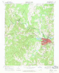
1968 Map of Farmville
USGS Topo · Published 1971About this map
Farmville stands as the central hub of this late-1960s survey, situated at the junction of the Appomattox River and the Norfolk and Western railroad. The town's identity is deeply tied to education and regional infrastructure, anchored by the expansive campus of Longwood College and the Prince Edward Academy. The river corridor itself marks the meeting point of Prince Edward, Cumberland, and Buckingham counties, with industrial and municipal features like the Filtration Plant and Sewage Disposal Ponds concentrated along the banks.
Find a feature on this map
47 named features on this map. Tap any name to fly to it.
Don’t see what you’re looking for? This feature index may not catch every label — zoom into the map to look around manually.
Map Details
Editions of this 1968 Farmville Map
4 editions found
Other maps of this area

1891 · Farmville
USGS Topo · 1:125,000

1892 · Appomattox
USGS Topo · 1:125,000

1893 · Farmville
USGS Topo · 1:125,000

1947 · Roanoke
USGS Topo · 1:250,000

1956 · Charlotte Court House
USGS Topo · 1:62,500

1958 · Farmville
USGS Topo · 1:62,500

1958 · Keysville
USGS Topo · 1:62,500

1958 · Pamplin City
USGS Topo · 1:62,500

1959 · Roanoke
USGS Topo · 1:250,000

1963 · Roanoke
USGS Topo · 1:250,000