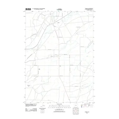
2012 Map of Farson
USGS Topo · Published 2012About this map
Farson and Eden serve as the primary hubs in this high-desert agricultural region of Sweetwater County, defined by an extensive grid of section roads and historic transportation corridors. The convergence of the Big Sandy River and Little Sandy Cr near Farson provides a vital water source for the surrounding valley, which is anchored by Eden Valley and the Eden Valley Cem. The landscape preserves traces of older western routes, including the Green River-South Pass Stage Rd and the Freight Wagon Rd, reflecting the area's significance as a junction for early travelers. To the south, the terrain descends into Washington Draw, while the local road network—including Eden Ryepatch Rd and Lower Farson Cutoff Rd—illustrates the organized settlement pattern of this Wyoming basin.
Find a feature on this map
30 named features on this map. Tap any name to fly to it.
Don’t see what you’re looking for? This feature index may not catch every label — zoom into the map to look around manually.
Map Details
Editions of this 2012 Farson Map
This is the sole edition of this map. No revisions or reprints were ever made.
Other maps of this area

1954 · Rock Springs
USGS Topo · 1:250,000

1955 · Lander
USGS Topo · 1:250,000

1958 · Lander
USGS Topo · 1:250,000

1958 · Rock Springs
USGS Topo · 1:250,000

1961 · Lander
USGS Topo · 1:250,000

1962 · Rock Springs
USGS Topo · 1:250,000

1963 · Pittman Well
USGS Topo · 1:24,000

1968 · Farson
USGS Topo · 1:24,000

1968 · Eden Reservoir East
USGS Topo · 1:24,000

1968 · Clay Buttes
USGS Topo · 1:24,000