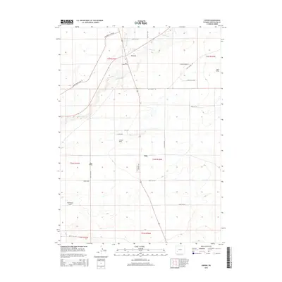
2015 Map of Farson
USGS Topo · Published 2015About this map
Big Sandy River and Little Sandy Cr converge near the settlements of Farson and Eden in this high-desert region of Sweetwater County. The map details a landscape where water management and ranching roads define the human footprint. Local landmarks like the Eden Valley Cem and the extensive grid of agricultural lanes—including Basco Ave and M and M Ave—illustrate the structured layout of the Eden Valley community. To the east, the Freight Wagon Rd and Griffinsville Loop suggest the region's historical transit routes, while deep drainage features such as Carlson Draw, Bone Draw, and Washington Draw punctuate the arid terrain. This contemporary survey preserves the naming conventions of a rural Wyoming irrigation district, showing the transition from wild riverbanks to a meticulously planned rural settlement pattern.
Find a feature on this map
31 named features on this map. Tap any name to fly to it.
Don’t see what you’re looking for? This feature index may not catch every label — zoom into the map to look around manually.
Map Details
Editions of this 2015 Farson Map
This is the sole edition of this map. No revisions or reprints were ever made.
Other maps of this area

1954 · Rock Springs
USGS Topo · 1:250,000

1955 · Lander
USGS Topo · 1:250,000

1958 · Lander
USGS Topo · 1:250,000

1958 · Rock Springs
USGS Topo · 1:250,000

1961 · Lander
USGS Topo · 1:250,000

1962 · Rock Springs
USGS Topo · 1:250,000

1963 · Pittman Well
USGS Topo · 1:24,000

1968 · Farson
USGS Topo · 1:24,000

1968 · Eden Reservoir East
USGS Topo · 1:24,000

1968 · Clay Buttes
USGS Topo · 1:24,000