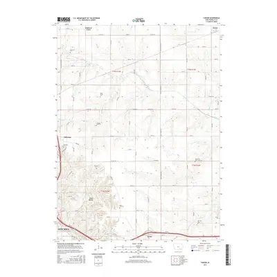
2015 Map of Farson
USGS Topo · Published 2015About this map
Highland Center and Farson anchor the northern landscape of this Wapello County region, where a dense network of country roads defines the rural character of southeastern Iowa. The topography is intricately carved by several waterways, including Cedar Cr and Little Cedar Cr, which snake through the townships of T73N and T72N. Genealogy and local history are exceptionally well-documented here through a series of family and community burial grounds such as McCormick Cem, Nasby Corner Cem, and Garrison Rock Cem. To the southwest, the edge of Ottumwa begins to appear near Loch Burns and the Sugar Cr drainage. This survey provides a precise look at the transition between established farming communities like Dahlonega and the outskirts of the larger urban hub, with notable landmarks like Round Point Cem and Sterner Cem marking the quiet intersections of this agricultural heartland.
Find a feature on this map
51 named features on this map. Tap any name to fly to it.
Don’t see what you’re looking for? This feature index may not catch every label — zoom into the map to look around manually.
Map Details
Editions of this 2015 Farson Map
This is the sole edition of this map. No revisions or reprints were ever made.
Other maps of this area

1954 · Centerville
USGS Topo · 1:250,000

1954 · Des Moines
USGS Topo · 1:250,000

1956 · Des Moines
USGS Topo · 1:250,000

1956 · Farson
USGS Topo · 1:24,000

1956 · Agency
USGS Topo · 1:24,000

1956 · Ottumwa North
USGS Topo · 1:62,500

1956 · Ottumwa South
USGS Topo · 1:24,000

1956 · Ottumwa South
USGS Topo · 1:62,500

1956 · Ottumwa North
USGS Topo · 1:24,000

1957 · Des Moines
USGS Topo · 1:250,000