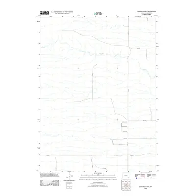
2012 Map of Farthing Ranch
USGS Topo · Published 2012About this map
Farthing Ranch serves as a primary landmark in this expanse of Laramie County, where the high plains landscape is defined by the winding course of Lodgepole Cr. The map reveals a transition toward modern rural development, with a structured grid of residential roads emerging in the southeast. Streets like Wheatland Dr, Chugwater Dr, and Guernsey Dr reflect a nomenclature tied to Wyoming regional identity, branching off Federal Blvd. This 2012 survey illustrates how traditional ranching territory is being organized into smaller parcels and connecting corridors, such as Ridley Rd and Ritzke Rd, while maintaining the essential character of the western rangeland and its vital water sources.
Find a feature on this map
19 named features on this map. Tap any name to fly to it.
Don’t see what you’re looking for? This feature index may not catch every label — zoom into the map to look around manually.
Map Details
Editions of this 2012 Farthing Ranch Map
This is the sole edition of this map. No revisions or reprints were ever made.
Other maps of this area

1905 · Sherman
USGS Topo · 1:125,000

1911 · Cheyenne
USGS Topo · 1:125,000

1914 · Cheyenne
USGS Topo · 1:125,000

1950 · Cheyenne
USGS Topo · 1:62,500

1954 · Cheyenne
USGS Topo · 1:250,000

1958 · Cheyenne
USGS Topo · 1:250,000

1961 · Round Top Lake
USGS Topo · 1:24,000

1961 · Cheyenne
USGS Topo · 1:62,500

1961 · Cheyenne North
USGS Topo · 1:24,000

1962 · P O Ranch
USGS Topo · 1:24,000