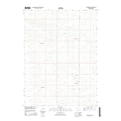
2015 Map of Farthing Ranch
USGS Topo · Published 2015About this map
Farthing Ranch sits as the central landmark of this ranching landscape in Laramie County, where the high plains terrain is etched by the meandering course of Lodgepole Creek. The map documents a sparsely populated region defined by large-scale land holdings and a network of county roads. The Public Land Survey System grid remains the dominant organizational feature here, with township lines for t16n r68w, t16n r67w, t15n r68w, and t15n r67w partitioning the territory. While much of the land remains dedicated to cattle ranching, the emergence of a residential street network in the southeastern quadrant—including Guernsey Drive, Chugwater Drive, and Morgan Drive—suggests a transition toward rural subdivision and residential development. This 2015 survey provides a clear look at the intersection of traditional Wyoming ranching life and modern land use patterns along Federal Road and County Road 120.
Find a feature on this map
18 named features on this map. Tap any name to fly to it.
Don’t see what you’re looking for? This feature index may not catch every label — zoom into the map to look around manually.
Map Details
Editions of this 2015 Farthing Ranch Map
This is the sole edition of this map. No revisions or reprints were ever made.
Other maps of this area

1905 · Sherman
USGS Topo · 1:125,000

1911 · Cheyenne
USGS Topo · 1:125,000

1914 · Cheyenne
USGS Topo · 1:125,000

1950 · Cheyenne
USGS Topo · 1:62,500

1954 · Cheyenne
USGS Topo · 1:250,000

1958 · Cheyenne
USGS Topo · 1:250,000

1961 · Round Top Lake
USGS Topo · 1:24,000

1961 · Cheyenne
USGS Topo · 1:62,500

1961 · Cheyenne North
USGS Topo · 1:24,000

1962 · P O Ranch
USGS Topo · 1:24,000