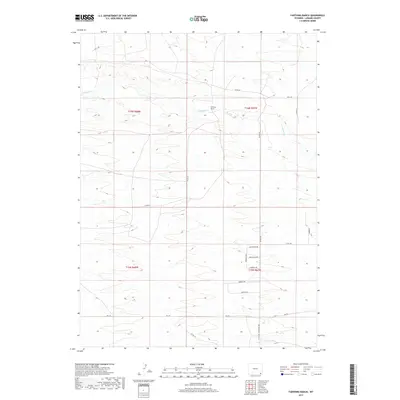
2017 Map of Farthing Ranch
USGS Topo · Published 2017About this map
Farthing Ranch sits as a central landmark in this high plains landscape of Laramie County, Wyoming. The terrain is defined by the winding course of Lodgepole Cr, which flows eastward across the northern half of the survey. The area is characterized by a grid of rural county roads and emerging residential streets, reflecting a transition from traditional ranching lands to more subdivided parcels. Notable named thoroughfares like Federal Blvd and Telephone Rd intersect the southern sections, providing a framework for the local transit network. Several streets, such as Chugwater Dr, Wheatland Dr, and Guernsey Dr, suggest a thematic naming convention linked to nearby regional destinations, while Morgan Dr and Federer Rd ground the map in local family names.
Find a feature on this map
23 named features on this map. Tap any name to fly to it.
Don’t see what you’re looking for? This feature index may not catch every label — zoom into the map to look around manually.
Map Details
Editions of this 2017 Farthing Ranch Map
This is the sole edition of this map. No revisions or reprints were ever made.
Other maps of this area

1905 · Sherman
USGS Topo · 1:125,000

1911 · Cheyenne
USGS Topo · 1:125,000

1914 · Cheyenne
USGS Topo · 1:125,000

1950 · Cheyenne
USGS Topo · 1:62,500

1954 · Cheyenne
USGS Topo · 1:250,000

1958 · Cheyenne
USGS Topo · 1:250,000

1961 · Round Top Lake
USGS Topo · 1:24,000

1961 · Cheyenne
USGS Topo · 1:62,500

1961 · Cheyenne North
USGS Topo · 1:24,000

1962 · P O Ranch
USGS Topo · 1:24,000