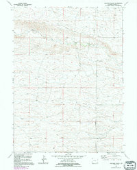
1991 Map of Farthing Ranch
USGS Topo · Published 1995About this map
Lodgepole Creek meanders through this portion of Laramie County, carving a subtle valley through the high plains landscape. The area is characterized by large agricultural holdings, most notably the namesake Farthing Ranch located in the northern half of the quadrangle. This 1991 inspection, based on earlier imagery and verified names from 1994, shows a terrain defined more by its surveying benchmarks and drainage patterns than by dense settlement. The southern reaches include the small site of Wadill and the Cheyenne East Base geodetic marker, illustrating the area's role in regional mapping and ranching. A single Gravel Pit and a long-distance Pipeline represent the minimal industrial incursions into this open grazing territory, which remains dominated by the natural contours of the creek and the vast sections of the Public Land Survey System.
Find a feature on this map
10 named features on this map. Tap any name to fly to it.
Don’t see what you’re looking for? This feature index may not catch every label — zoom into the map to look around manually.
Map Details
Editions of this 1991 Farthing Ranch Map
This is the sole edition of this map. No revisions or reprints were ever made.
Other maps of this area

1905 · Sherman
USGS Topo · 1:125,000

1911 · Cheyenne
USGS Topo · 1:125,000

1914 · Cheyenne
USGS Topo · 1:125,000

1950 · Cheyenne
USGS Topo · 1:62,500

1954 · Cheyenne
USGS Topo · 1:250,000

1958 · Cheyenne
USGS Topo · 1:250,000

1961 · Round Top Lake
USGS Topo · 1:24,000

1961 · Cheyenne
USGS Topo · 1:62,500

1961 · Cheyenne North
USGS Topo · 1:24,000

1962 · P O Ranch
USGS Topo · 1:24,000