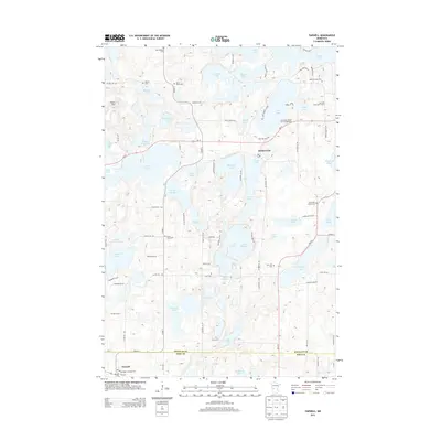
2013 Map of Farwell
USGS Topo · Published 2013About this map
Holmes City and the surrounding glacial lake district of Douglas County define this landscape, where early pioneer heritage is preserved through a dense network of country cemeteries. The map reveals a high concentration of sites important to local genealogy and Scandinavian settlement history, including the Finnish Cem, Saint Paul's Cem, and Trysil Cem. To the south, the village of Farwell sits along MN-55 at the border of Pope County, serving as a gateway to the region's recreation areas. The terrain is marked by dozens of water bodies like Lobster Lake and Lake Oscar, which have supported a transition from purely agricultural use to modern vacation spots like the Sun Valley Resort and Campground. The intricate shoreline of Lake Rachel and the many smaller potholes such as Kron Lakes illustrate the classic Minnesota prairie-pothole topography.
Find a feature on this map
93 named features on this map. Tap any name to fly to it.
Don’t see what you’re looking for? This feature index may not catch every label — zoom into the map to look around manually.
Map Details
Editions of this 2013 Farwell Map
This is the sole edition of this map. No revisions or reprints were ever made.
Other maps of this area

1953 · Saint Cloud
USGS Topo · 1:250,000

1957 · Saint Cloud
USGS Topo · 1:250,000

1958 · Saint Cloud
USGS Topo · 1:250,000

1966 · Brandon
USGS Topo · 1:24,000

1966 · Alexandria West
USGS Topo · 1:24,000

1966 · Farwell
USGS Topo · 1:24,000

1966 · Kensington
USGS Topo · 1:24,000

1966 · Quam Lake
USGS Topo · 1:24,000

1966 · Lake Mary
USGS Topo · 1:24,000

1968 · Lowry
USGS Topo · 1:24,000