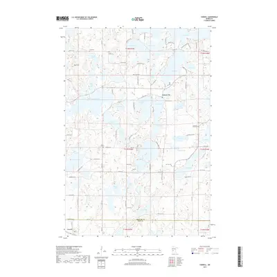
2019 Map of Farwell
USGS Topo · Published 2019About this map
Holmes City serves as a central hub in this lake-strewn portion of West Central Minnesota, situated near the shores of Grant Lake and Blackwell Lake. The landscape is defined by its dense concentration of glacial basins, ranging from the expansive Lake Oscar and Lake Rachel to smaller, family-named waters like Mattson Lake and Wesen Lake. This map reveals a distinct pattern of rural settlement, where community life centered around local congregations and their associated burial grounds. Genealogists will find a significant distribution of historical sites, including Finnish Cem, Saint Paul's Cem, and Trysil Cem. In the southwest corner, the village of Farwell sits just south of the border between Douglas Co and Pope Co, while the prominent elevation of Tower Hill overlooks the surrounding wetlands and agricultural tracts.
Find a feature on this map
89 named features on this map. Tap any name to fly to it.
Don’t see what you’re looking for? This feature index may not catch every label — zoom into the map to look around manually.
Map Details
Editions of this 2019 Farwell Map
This is the sole edition of this map. No revisions or reprints were ever made.
Other maps of this area

1953 · Saint Cloud
USGS Topo · 1:250,000

1957 · Saint Cloud
USGS Topo · 1:250,000

1958 · Saint Cloud
USGS Topo · 1:250,000

1966 · Brandon
USGS Topo · 1:24,000

1966 · Alexandria West
USGS Topo · 1:24,000

1966 · Farwell
USGS Topo · 1:24,000

1966 · Kensington
USGS Topo · 1:24,000

1966 · Quam Lake
USGS Topo · 1:24,000

1966 · Lake Mary
USGS Topo · 1:24,000

1968 · Lowry
USGS Topo · 1:24,000