
1957 Map of Farwell
USGS Topo · Published 1959About this map
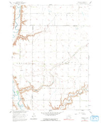
The James River carves a deep valley through the western edge of this prairie landscape, defining the topography of Butler and Perry townships. During the late 1950s, the rural community structure was anchored by localized hubs like Farwell, where the Farwell Ch and Farwell Sch served the surrounding farmsteads. The eastern half of the map reveals the meandering course of Rock Creek, where the Rock Creek Cem sits on a plateau overlooking the water's edge.
Find a feature on this map
19 named features on this map. Tap any name to fly to it.
Don’t see what you’re looking for? This feature index may not catch every label — zoom into the map to look around manually.
Map Details
Editions of this 1957 Farwell Map
2 editions found
Other maps of this area

1899 · Mitchell
USGS Topo · 1:125,000

1899 · Alexandria
USGS Topo · 1:125,000

1955 · Sioux Falls
USGS Topo · 1:250,000

1955 · Mitchell
USGS Topo · 1:250,000

1957 · Alexandria
USGS Topo · 1:24,000

1957 · Farwell NW
USGS Topo · 1:24,000

1957 · Loomis
USGS Topo · 1:24,000

1957 · Riverside
USGS Topo · 1:24,000

1957 · Letcher NE
USGS Topo · 1:24,000

1957 · Mitchell
USGS Topo · 1:24,000