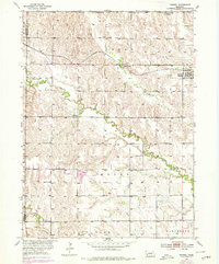
1953 Map of Farwell
USGS Topo · Published 1978About this map
Farwell (Posen) serves as the central hub of this Nebraska prairie landscape, situated along the Burlington Northern railroad corridor. The area is defined by a dense network of rural infrastructure, featuring numerous school districts such as School No 78 and School No 32, which reflect the distributed settlement pattern common before regional consolidation. The landscape is carved by a series of south-flowing waterways, including Oak Creek, Turkey Creek, and Cow Creek, which dictate the local topography and the placement of farms.
Find a feature on this map
22 named features on this map. Tap any name to fly to it.
Don’t see what you’re looking for? This feature index may not catch every label — zoom into the map to look around manually.
Map Details
Editions of this 1953 Farwell Map
2 editions found
Other maps of this area

1899 · Loup
USGS Topo · 1:125,000

1953 · Dannebrog
USGS Topo · 1:24,000

1953 · Cotesfield
USGS Topo · 1:24,000

1953 · Rockville
USGS Topo · 1:24,000

1953 · Boelus
USGS Topo · 1:24,000

1953 · Loup City SE
USGS Topo · 1:24,000

1953 · Farwell
USGS Topo · 1:24,000

1953 · Nysted
USGS Topo · 1:24,000

1953 · Ashton
USGS Topo · 1:24,000

1953 · Elba
USGS Topo · 1:24,000