
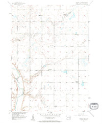
1957 Map of Farwell NW
USGS Topo · Published 1958About this map
The James River carves through the southwestern corner of this Sanborn Co landscape, which reflects a period of rural transition in the late 1950s. The township structure is clearly defined by the boundaries of Union, Diana, Butler, and Ravenna, showcasing a classic prairie section-line grid. A notable pattern of consolidation or decline is evident in the rural education system, as several local schoolhouses are already marked as defunct. These include the Hodson Sch, Sheldon Sch, Ludwig Sch, and Lyle Sch, while the Goering Sch remains a functional landmark. Waterways like Jim Creek and Dry Run traverse the townships, providing the primary relief in an otherwise strictly organized agricultural environment mapped as part of the Missouri River Basin development program.
Find a feature on this map
13 named features on this map. Tap any name to fly to it.
Don’t see what you’re looking for? This feature index may not catch every label — zoom into the map to look around manually.
Map Details
Editions of this 1957 Farwell NW Map
2 editions found
Other maps of this area

1898 · Huron
USGS Topo · 1:125,000

1899 · Mitchell
USGS Topo · 1:125,000

1899 · Alexandria
USGS Topo · 1:125,000

1899 · De Smet
USGS Topo · 1:125,000

1953 · Huron
USGS Topo · 1:250,000

1953 · Watertown
USGS Topo · 1:250,000

1954 · Huron
USGS Topo · 1:250,000

1955 · Sioux Falls
USGS Topo · 1:250,000

1955 · Mitchell
USGS Topo · 1:250,000

1957 · Loomis
USGS Topo · 1:24,000
Featured Places
- Butler Township, SD
- Diana Township, SD
- Upland Hutterite Colony, SD
- Union Township, SD
- Ravenna Township, SD