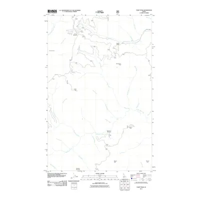
2011 Map of Faset Peak
USGS Topo · Published 2011About this map
Dixie Queen Mine stands as a focal point for historic activity in this high-altitude drainage of Kootenai County. The landscape is defined by a series of prominent summits, including Faset Peak, North Snow Peak, and Magee Peak, which overlook a complex network of waterways such as Spruce Creek and Independence Creek. Settlement is minimal in this wilderness, though Snowbird Meadows provides a rare named clearing among the steep ridges. Transportation through this backcountry relies on several established routes, notably the Pend Oreille Divide Rd and Spruce Divide Rd, which trace the high ground between watersheds. The map reveals the intricate drainage patterns of the Coeur d'Alene National Forest area, where numerous creeks like Surprise Creek and Declaration Creek carve through the terrain, illustrating the remote and industrial geography of Northern Idaho.
Find a feature on this map
37 named features on this map. Tap any name to fly to it.
Don’t see what you’re looking for? This feature index may not catch every label — zoom into the map to look around manually.
Map Details
Editions of this 2011 Faset Peak Map
This is the sole edition of this map. No revisions or reprints were ever made.
Other maps of this area

1909 · Cataldo
USGS Topo · 1:125,000

1911 · Cataldo
USGS Topo · 1:125,000

1911 · Priest Lake
USGS Topo · 1:250,000

1913 · Priest Lake
USGS Topo · 1:250,000

1949 · Packsaddle Mtn
USGS Topo · 1:62,500

1951 · Packsaddle Mtn
USGS Topo · 1:62,500

1951 · Clark Fork
USGS Topo · 1:62,500

1955 · Spokane
USGS Topo · 1:250,000

1958 · Spokane
USGS Topo · 1:250,000

1958 · Sandpoint
USGS Topo · 1:250,000