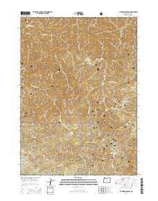
2014 Map of Father Mountain
USGS Topo · Published 2014About this map
Father Mountain and the high coastal ridges of Siskiyou National Forest define this landscape, where steep topography and a complex network of forest roads reveal the timber and conservation history of Curry County. The Elk River and its tributaries, including Platinum Cr and State Cr, carve deep drainages through the terrain, while landmarks like Pearse Peak and Purple Mtn mark the high points of the northern section. This 2014 survey documents the continued use of an extensive forest service road system, such as Nat For Dev Rd 5325 and Rocky Peak Rd, which provide access to these remote reaches. To the south, Chismore Butte and the headwaters of Euchre Cr and Mussel Cr indicate the watershed divide between the Elk River basin and the southern coastal creeks.
Find a feature on this map
43 named features on this map. Tap any name to fly to it.
Don’t see what you’re looking for? This feature index may not catch every label — zoom into the map to look around manually.
Map Details
Editions of this 2014 Father Mountain Map
This is the sole edition of this map. No revisions or reprints were ever made.
Other maps of this area

1899 · Port Orford
USGS Topo · 1:125,000

1903 · Port Orford
USGS Topo · 1:125,000

1954 · Coos Bay
USGS Topo · 1:250,000

1954 · Port Orford
USGS Topo · 1:62,500

1954 · Agness
USGS Topo · 1:62,500

1954 · Powers
USGS Topo · 1:62,500

1954 · Langlois
USGS Topo · 1:62,500

1958 · Coos Bay
USGS Topo · 1:250,000

1962 · Coos Bay
USGS Topo · 1:250,000
1986 · Father Mountain
USGS Topo · 1:24,000