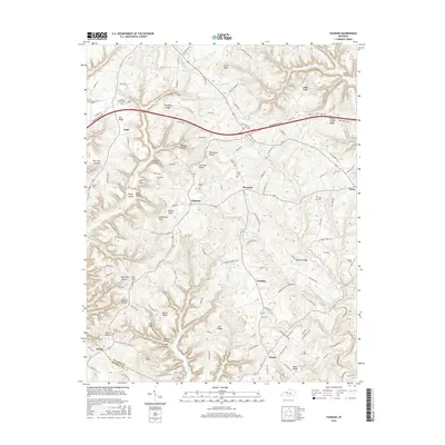
2016 Map of Faubush
USGS Topo · Published 2016About this map
Faubush and the surrounding rural communities of Burnetta, Norfleet, and Naomi sit atop a dissected plateau where the Pulaski Co and Russell Co line intersects. The landscape is characterized by a dense network of ridges and hollows, such as Newhope Ridge, Happy Ridge, and Ducky Hollow, which dictate the winding paths of local roads like Old Columbia Rd and Faubush-Norfleet Rd. The drainage pattern is equally complex, with Wolf Cr, Faubush Cr, and White Oak Cr carving deep into the terrain.
Find a feature on this map
145 named features on this map. Tap any name to fly to it.
Don’t see what you’re looking for? This feature index may not catch every label — zoom into the map to look around manually.
Map Details
Editions of this 2016 Faubush Map
This is the sole edition of this map. No revisions or reprints were ever made.
Other maps of this area

1911 · Monticello
USGS Topo · 1:62,500

1914 · Monticello
USGS Topo · 1:62,500

1932 · Burnside
USGS Topo · 1:62,500

1935 · Somerset
USGS Topo · 1:62,500

1953 · Phil
USGS Topo · 1:24,000

1953 · Frazer
USGS Topo · 1:24,000

1953 · Mintonville
USGS Topo · 1:24,000

1953 · Mill Springs
USGS Topo · 1:24,000

1954 · Jabez
USGS Topo · 1:24,000

1954 · Delmer
USGS Topo · 1:24,000