1952 Map of Faulkton East
USGS Topo · Published 1978About this map
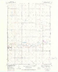
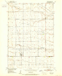
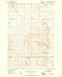
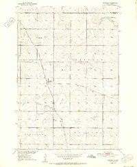
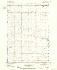
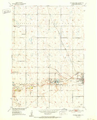
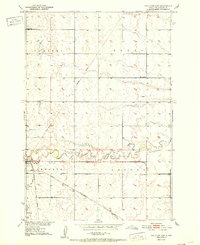
Faulkton serves as the primary hub of this eastern South Dakota landscape, which was mapped in detail by the Geological Survey during the mid-century. The township divisions of Pulaski, Myron, Tamworth, and Lafoon organize the prairie terrain, where the meandering South Fork Snake Creek provides the principal natural drainage. This era shows a community infrastructure defined by distributed rural education, with the Melius Sch, Reed Sch, and Lafoon Sch positioned to serve the surrounding farmsteads. Transportation patterns on the sheet reveal a mix of modern and legacy infrastructure, including the Municipal Airport near a local Water Tank and the clear remains of an Old Railroad Grade cutting across the northern sections. Genealogists may find particular value in the documentation of the Faulkton Cem and the various Gravel Pits that suggest local mineral extraction industries of the time.
Find a feature on this map
14 named features on this map. Tap any name to fly to it.
Don’t see what you’re looking for? This feature index may not catch every label — zoom into the map to look around manually.
Map Details
Editions of this 1952 Faulkton East Map
2 editions found
Other maps of this area

1899 · Northville
USGS Topo · 1:125,000

1899 · Redfield
USGS Topo · 1:125,000
1951 · Orient
USGS Topo · 1:24,000
1951 · Orient NW
USGS Topo · 1:24,000
1952 · Norbeck
USGS Topo · 1:24,000
1952 · Wecota
USGS Topo · 1:24,000
1952 · Faulkton West
USGS Topo · 1:24,000
1952 · Faulkton East
USGS Topo · 1:24,000

1953 · Huron
USGS Topo · 1:250,000

1954 · Aberdeen
USGS Topo · 1:250,000