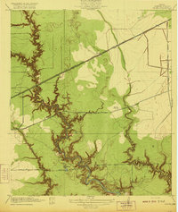
1920 Map of Fauna
USGS Topo · Published 1920About this map
Greens Bayou winds through the heart of this East Texas coastal landscape, its deeply etched banks and tributaries like Spring Gully and Big Gulch defining the local drainage patterns long before the intensive industrialization of the region. The map reflects a rural economy dependent on a few key arteries, most notably the Southern Pacific System rail line and several established thoroughfares such as the Market Street Road. Settlement is sparse, anchored by the rail stop at Fauna and the local landmark of Abbots Store to the south. The surrounding terrain varies from the low-lying wetlands of Carpenters Bayou to the slightly elevated grounds of Round Prairie, providing a detailed record of the topography and natural drainage features of Harris County shortly after the First World War.
Find a feature on this map
13 named features on this map. Tap any name to fly to it.
Don’t see what you’re looking for? This feature index may not catch every label — zoom into the map to look around manually.
Map Details
Editions of this 1920 Fauna Map
This is the sole edition of this map. No revisions or reprints were ever made.
Other maps of this area

1915 · Park Place
USGS Topo · 1:24,000

1915 · Deepwater
USGS Topo · 1:24,000

1916 · Burnett Bay
USGS Topo · 1:24,000

1916 · Crosby
USGS Topo · 1:24,000

1916 · Settegast
USGS Topo · 1:24,000

1916 · Fauna
USGS Topo · 1:24,000

1916 · Harmaston
USGS Topo · 1:24,000

1916 · Humble
USGS Topo · 1:24,000

1916 · La Porte
USGS Topo · 1:24,000

1919 · Deepwater
USGS Topo · 1:31,680