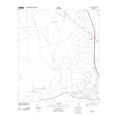
2012 Map of Favoretta
USGS Topo · Published 2012About this map
The Little Tomoka River and its tributary, Groover Br, define the hydrology of this landscape just inland from the Florida coast. This 2012 survey documents a period of transitioning land use, where older rural crossroads like Favoretta and the settlement of National Gardens meet modern development. The transportation network is a central theme, showing the path of the Old Dixie Hwy alongside modern routes like Destination Daytona Ln. Local aviation and residential expansion are evident through features like the Big 'G' Airport and the suburban layout of Hunters Ridge Blvd. The map provides a clear look at how the region's historical county roads, including Co Rd 200 and Co Rd 203, interface with the newer infrastructure required by the growing Daytona Beach area.
Find a feature on this map
63 named features on this map. Tap any name to fly to it.
Don’t see what you’re looking for? This feature index may not catch every label — zoom into the map to look around manually.
Map Details
Editions of this 2012 Favoretta Map
This is the sole edition of this map. No revisions or reprints were ever made.
Other maps of this area

1937 · Ormond
USGS Topo · 1:48,000

1944 · Ormond
USGS Topo · 1:62,500

1952 · Daytona Beach
USGS Topo · 1:24,000

1954 · Daytona Beach
USGS Topo · 1:250,000

1956 · Favoretta
USGS Topo · 1:24,000

1956 · Flagler Beach East
USGS Topo · 1:24,000

1956 · Flagler Beach West
USGS Topo · 1:24,000

1956 · Ormond Beach
USGS Topo · 1:24,000

1958 · Daytona Beach
USGS Topo · 1:250,000

1962 · Daytona Beach NW
USGS Topo · 1:24,000