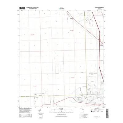
2015 Map of Favoretta
USGS Topo · Published 2015About this map
Ormond Beach expansion meets the wetlands of the Little Tomoka River in this detailed survey of the Volusia and Flagler County border. The landscape transitions from the established settlement of Favoretta and the residential corridors of National Gardens to the emerging subdivisions near Hunter's Ridge Blvd and Canterbury Wds. Significant local landmarks include the Big 'G' Airport and the commercial activity around Destination Daytona Ln. The map also illustrates the natural drainage patterns of the region, anchored by the Sawgrass Lake basin and the winding course of Groover Br, providing a clear view of how modern transportation routes and housing developments have been integrated into the Florida coastal lowlands.
Find a feature on this map
86 named features on this map. Tap any name to fly to it.
Don’t see what you’re looking for? This feature index may not catch every label — zoom into the map to look around manually.
Map Details
Editions of this 2015 Favoretta Map
This is the sole edition of this map. No revisions or reprints were ever made.
Other maps of this area

1937 · Ormond
USGS Topo · 1:48,000

1944 · Ormond
USGS Topo · 1:62,500

1952 · Daytona Beach
USGS Topo · 1:24,000

1954 · Daytona Beach
USGS Topo · 1:250,000

1956 · Favoretta
USGS Topo · 1:24,000

1956 · Flagler Beach East
USGS Topo · 1:24,000

1956 · Flagler Beach West
USGS Topo · 1:24,000

1956 · Ormond Beach
USGS Topo · 1:24,000

1958 · Daytona Beach
USGS Topo · 1:250,000

1962 · Daytona Beach NW
USGS Topo · 1:24,000