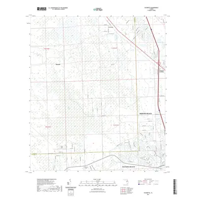
2021 Map of Favoretta
USGS Topo · Published 2021About this map
Favoretta and the surrounding pine flatwoods of the Florida Atlantic coast define this landscape during the early 21st century. The map illustrates a transitional zone where the northern outskirts of Ormond Beach and Daytona Beach meet the extensive wetlands and conservation areas of Flagler and Volusia counties. Large-scale hydrological features such as Lake Swamp, Hull Cypress Swamp, and the winding Little Tomoka River dominate the interior, punctuated by the distinct elevation of Rima Ridge. Small aviation nodes like The 2A Ranch Airport and Squillacote Airport indicate the rural-residential nature of the land between established settlements. Grounded in a 2021 survey, the map preserves the alignment of the Old Dixie Hwy alongside newer developments like National Gardens, showcasing the steady northward expansion of the coast's urban corridor into the cypress strands of Tiger Bay.
Find a feature on this map
80 named features on this map. Tap any name to fly to it.
Don’t see what you’re looking for? This feature index may not catch every label — zoom into the map to look around manually.
Map Details
Editions of this 2021 Favoretta Map
This is the sole edition of this map. No revisions or reprints were ever made.
Other maps of this area

1937 · Ormond
USGS Topo · 1:48,000

1944 · Ormond
USGS Topo · 1:62,500

1952 · Daytona Beach
USGS Topo · 1:24,000

1954 · Daytona Beach
USGS Topo · 1:250,000

1956 · Favoretta
USGS Topo · 1:24,000

1956 · Flagler Beach East
USGS Topo · 1:24,000

1956 · Flagler Beach West
USGS Topo · 1:24,000

1956 · Ormond Beach
USGS Topo · 1:24,000

1958 · Daytona Beach
USGS Topo · 1:250,000

1962 · Daytona Beach NW
USGS Topo · 1:24,000