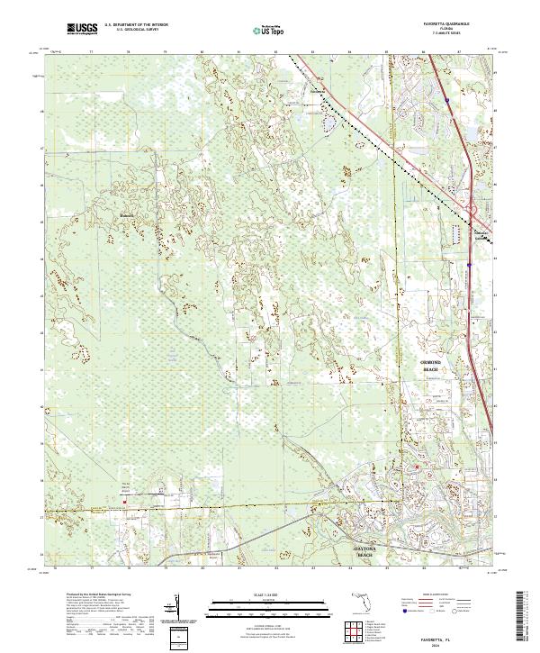
2024 Map of Favoretta
USGS Topo · Published 2024About this map
Favoretta and National Gardens stand as small focal points within a landscape dominated by the transition between the pine flatwoods of the Rima Ridge and the dense wetlands of the Hull Cypress Swamp. This 2024 survey captures the interface of established settlements and the natural drainage systems of the Little Tomoka River and Groover Branch. The presence of The 2A Ranch Airport and Squillacote Airport suggests the continued importance of private aviation in this part of Florida. Movement through the area is defined by modern infrastructure alongside remnants of the past, notably the Old Dixie Hwy, which skirts the eastern edge of the swampy terrain near Lake Swamp. This map provides a detailed view of the Flagler and Volusia county line, showing how local roads like Durrance Ln and Twin Lakes Rd navigate the complex hydrology of Tiger Bay and Gator Head.
Find a feature on this map
94 named features on this map. Tap any name to fly to it.
Don’t see what you’re looking for? This feature index may not catch every label — zoom into the map to look around manually.
Map Details
Editions of this 2024 Favoretta Map
This is the sole edition of this map. No revisions or reprints were ever made.
Other maps of this area

1937 · Ormond
USGS Topo · 1:48,000

1944 · Ormond
USGS Topo · 1:62,500

1952 · Daytona Beach
USGS Topo · 1:24,000

1954 · Daytona Beach
USGS Topo · 1:250,000

1956 · Favoretta
USGS Topo · 1:24,000

1956 · Flagler Beach East
USGS Topo · 1:24,000

1956 · Flagler Beach West
USGS Topo · 1:24,000

1956 · Ormond Beach
USGS Topo · 1:24,000

1958 · Daytona Beach
USGS Topo · 1:250,000

1962 · Daytona Beach NW
USGS Topo · 1:24,000