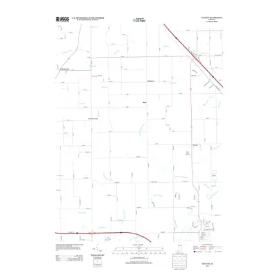
2013 Map of Fayette
USGS Topo · Published 2013About this map
White Lick Creek and its complex network of managed waterways define the agrarian landscape of eastern Hendricks County in this 2013 survey. The area maintains a pattern of dispersed rural settlements, from Fayette in the east to Milledgeville at the western edge. These small centers are connected by a rigid grid of county roads that navigate the drainage basins of Fishback Creek and the West Fork White Lick Creek. Significant effort in land management is evident through numerous named drainage projects such as Wiley Thompson Ditch, Beaman Ditch, and Edlin Ditch, which support the surrounding agricultural fields. Near the community of Fayette, the White Lick Golf Course represents a transition in land use, while landmarks like Seven Mile Prairie and Herr provide anchor points for local history and genealogical research in this part of Indiana.
Find a feature on this map
127 named features on this map. Tap any name to fly to it.
Don’t see what you’re looking for? This feature index may not catch every label — zoom into the map to look around manually.
Map Details
Editions of this 2013 Fayette Map
This is the sole edition of this map. No revisions or reprints were ever made.
Other maps of this area

1953 · Fayette
USGS Topo · 1:24,000

1953 · Rosston
USGS Topo · 1:24,000

1953 · Lizton
USGS Topo · 1:24,000

1953 · Danville
USGS Topo · 1:24,000

1953 · Brownsburg
USGS Topo · 1:24,000

1953 · Zionsville
USGS Topo · 1:24,000

1953 · Lebanon
USGS Topo · 1:24,000

1953 · Clermont
USGS Topo · 1:24,000

1953 · Danville
USGS Topo · 1:250,000

1953 · Indianapolis
USGS Topo · 1:250,000