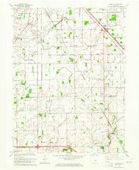
1963 Map of Fayette
USGS Topo · Published 1964About this map
White Lick Creek and its various forks carve through this rural landscape along the boundary of Boone and Hendricks counties. The 1963 revision highlights a traditional agricultural region transitioning with modern infrastructure, including several prominent Pipeline corridors and the Pennsylvania Railroad cutting diagonally across the northeastern corner. Smaller unincorporated communities like Milledgeville and Fayette serve as local hubs, anchored by neighborhood landmarks such as Mt Tabor Ch and Central Sch.
Find a feature on this map
54 named features on this map. Tap any name to fly to it.
Don’t see what you’re looking for? This feature index may not catch every label — zoom into the map to look around manually.
Map Details
Editions of this 1963 Fayette Map
This is the sole edition of this map. No revisions or reprints were ever made.
Other maps of this area

1953 · Fayette
USGS Topo · 1:24,000

1953 · Rosston
USGS Topo · 1:24,000

1953 · Lizton
USGS Topo · 1:24,000

1953 · Danville
USGS Topo · 1:24,000

1953 · Brownsburg
USGS Topo · 1:24,000

1953 · Zionsville
USGS Topo · 1:24,000

1953 · Lebanon
USGS Topo · 1:24,000

1953 · Clermont
USGS Topo · 1:24,000

1953 · Danville
USGS Topo · 1:250,000

1953 · Indianapolis
USGS Topo · 1:250,000