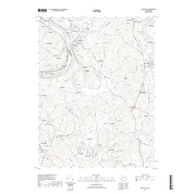
2019 Map of Fayette City
USGS Topo · Published 2019About this map
The Monongahela River carves a deep valley through the western edge of this landscape, separating the communities of Speers and Belle Vernon. Along the river's winding course, industrial and residential hubs like Fayette City, Stockdale, and Roscoe sit nestled at the base of the steep Allenport Hollow. To the east, the terrain rises into the rolling hills of Fayette County, where the smaller Youghiogheny River clips the northeastern corner near Banning.
Find a feature on this map
188 named features on this map. Tap any name to fly to it.
Don’t see what you’re looking for? This feature index may not catch every label — zoom into the map to look around manually.
Map Details
Editions of this 2019 Fayette City Map
This is the sole edition of this map. No revisions or reprints were ever made.
Other maps of this area

1900 · Uniontown
USGS Topo · 1:62,500

1900 · Masontown
USGS Topo · 1:62,500

1902 · Brownsville
USGS Topo · 1:62,500

1902 · Connellsville
USGS Topo · 1:62,500

1903 · Masontown
USGS Topo · 1:62,500

1906 · Brownsville
USGS Topo · 1:62,500

1931 · Brownsville
USGS Topo · 1:62,500

1931 · Connellsville
USGS Topo · 1:62,500

1931 · Uniontown
USGS Topo · 1:62,500

1931 · Masontown
USGS Topo · 1:62,500