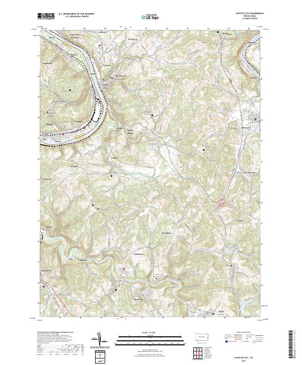
2023 Map of Fayette City
USGS Topo · Published 2023About this map
The Monongahela River carves a deep valley through this corner of Western Pennsylvania, serving as a historic county line between Fayette and Washington. Riverside industrial and residential hubs like Fayette City, Roscoe, and Stockdale cling to the banks, while the Wheeling-Pitts RR follows the water’s edge. Inland, the terrain rises into a series of ridges and hollows defined by the Little Redstone Creek watershed.
Find a feature on this map
164 named features on this map. Tap any name to fly to it.
Don’t see what you’re looking for? This feature index may not catch every label — zoom into the map to look around manually.
Map Details
Editions of this 2023 Fayette City Map
This is the sole edition of this map. No revisions or reprints were ever made.
Other maps of this area

1900 · Uniontown
USGS Topo · 1:62,500

1900 · Masontown
USGS Topo · 1:62,500

1902 · Brownsville
USGS Topo · 1:62,500

1902 · Connellsville
USGS Topo · 1:62,500

1903 · Masontown
USGS Topo · 1:62,500

1906 · Brownsville
USGS Topo · 1:62,500

1931 · Brownsville
USGS Topo · 1:62,500

1931 · Connellsville
USGS Topo · 1:62,500

1931 · Uniontown
USGS Topo · 1:62,500

1931 · Masontown
USGS Topo · 1:62,500