
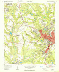
1950 Map of Fayetteville
USGS Topo · Published 1950About this map
Fayetteville expands westward in the post-war era, its urban grid meeting the rural landscapes of Seventy First and Pearces Mill. The city's growth is anchored by institutions like the State Teachers College and the Highsmith Hosp, while the Fort Bragg Military Reservation and its pumping station define the northwestern boundary. This period shows a transition from small outlying settlements such as Skibo and Lakedale toward a more integrated suburban footprint.
Find a feature on this map
66 named features on this map. Tap any name to fly to it.
Don’t see what you’re looking for? This feature index may not catch every label — zoom into the map to look around manually.
Map Details
Editions of this 1950 Fayetteville Map
2 editions found
Other maps of this area

1948 · Fayetteville
USGS Topo · 1:62,500

1948 · Clifdale
USGS Topo · 1:62,500

1948 · Slocomb
USGS Topo · 1:24,000

1948 · Clifdale
USGS Topo · 1:24,000

1949 · Vander
USGS Topo · 1:24,000

1950 · Clifdale
USGS Topo · 1:24,000

1950 · Manchester
USGS Topo · 1:24,000

1950 · Slocomb
USGS Topo · 1:24,000

1951 · Clifdale
USGS Topo · 1:62,500

1953 · Florence
USGS Topo · 1:250,000