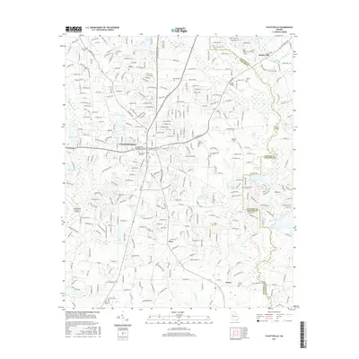
2017 Map of Fayetteville
USGS Topo · Published 2017About this map
Fayetteville serves as the central hub of this 2017 Georgia landscape, showing a dense network of residential development and suburban expansion. The area is defined by numerous small water bodies such as Stinchcomb Lake, Fowler Lake, and Lake Fayette, alongside the southward flow of Ginger Cake Cr and Morning Cr. Local landmarks include the Mc Lendon Airport to the northwest and Walker Field near the Clayton County line.
Find a feature on this map
359 named features on this map. Tap any name to fly to it.
Don’t see what you’re looking for? This feature index may not catch every label — zoom into the map to look around manually.
Map Details
Editions of this 2017 Fayetteville Map
This is the sole edition of this map. No revisions or reprints were ever made.
Other maps of this area

1888 · Atlanta
USGS Topo · 1:125,000

1890 · Atlanta
USGS Topo · 1:125,000

1891 · Marietta
USGS Topo · 1:125,000

1892 · Atlanta
USGS Topo · 1:125,000

1895 · Atlanta
USGS Topo · 1:125,000

1895 · Marietta
USGS Topo · 1:125,000

1897 · Marietta
USGS Topo · 1:125,000

1901 · Marietta
USGS Topo · 1:125,000

1953 · Atlanta
USGS Topo · 1:250,000

1954 · Fairburn
USGS Topo · 1:24,000