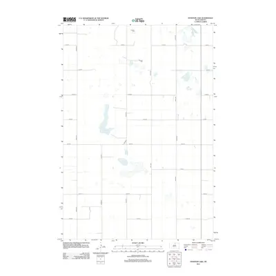
2012 Map of Feinstein Lake
USGS Topo · Published 2012About this map
Glacial prairie potholes and localized drainage basins define this portion of Campbell County, where Feinstein Lake and Heupel Lake serve as primary hydrographic markers. The landscape is organized by a strict section-line grid of rural roads, including 322nd Ave and 117th St, which facilitate movement through this agricultural region. A significant historical marker is found at the Neudorf Cem, located in the northern section of the survey. This cemetery, along with the family-named lakes, provides a vital link to the early German-Russian or European homesteading families who settled this part of South Dakota. The presence of Co Hwy-1 cutting diagonally across the southern grid reflects a shift in transportation patterns from the rigid section-line survey to modern regional connectivity.
Find a feature on this map
17 named features on this map. Tap any name to fly to it.
Don’t see what you’re looking for? This feature index may not catch every label — zoom into the map to look around manually.
Map Details
Editions of this 2012 Feinstein Lake Map
This is the sole edition of this map. No revisions or reprints were ever made.
Other maps of this area

1954 · Aberdeen
USGS Topo · 1:250,000

1956 · Aberdeen
USGS Topo · 1:250,000

1978 · Hillsview SE
USGS Topo · 1:24,000

1978 · Bowdle-Hosmer Lake
USGS Topo · 1:24,000

1978 · Java SE
USGS Topo · 1:24,000

1978 · Eureka West
USGS Topo · 1:24,000

1978 · Flat Lake
USGS Topo · 1:24,000

1978 · Feinstein Lake
USGS Topo · 1:24,000

1978 · Eureka East
USGS Topo · 1:24,000

1978 · Mutske Lake
USGS Topo · 1:24,000