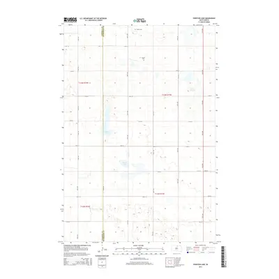
2015 Map of Feinstein Lake
USGS Topo · Published 2015About this map
Glacial depressions and prairie potholes define the landscape along the border of Campbell Co and McPherson Co in this rural South Dakota survey. The hydrology of the region is centered on Feinstein Lake and Heupel Lake, which are part of a larger network of seasonal wetlands and scattered water bodies. The land is organized by a precise grid of rural roads, including 114th St and 324th Ave, reflecting the systematic agricultural development of the northern plains. For genealogists and local historians, the presence of the Neudorf Cem in the northern portion of the quadrangle provides a specific point of reference for early settlement patterns and family lineages in this sparsely populated township.
Find a feature on this map
22 named features on this map. Tap any name to fly to it.
Don’t see what you’re looking for? This feature index may not catch every label — zoom into the map to look around manually.
Map Details
Editions of this 2015 Feinstein Lake Map
This is the sole edition of this map. No revisions or reprints were ever made.
Other maps of this area

1954 · Aberdeen
USGS Topo · 1:250,000

1956 · Aberdeen
USGS Topo · 1:250,000

1978 · Hillsview SE
USGS Topo · 1:24,000

1978 · Bowdle-Hosmer Lake
USGS Topo · 1:24,000

1978 · Java SE
USGS Topo · 1:24,000

1978 · Eureka West
USGS Topo · 1:24,000

1978 · Flat Lake
USGS Topo · 1:24,000

1978 · Feinstein Lake
USGS Topo · 1:24,000

1978 · Eureka East
USGS Topo · 1:24,000

1978 · Mutske Lake
USGS Topo · 1:24,000