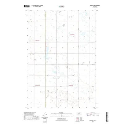
2017 Map of Feinstein Lake
USGS Topo · Published 2017About this map
The border of Campbell and McPherson Counties divides this pocket of the South Dakota prairie, where small family-named sites reflect the area's rural heritage. Small prairie lakes and wetlands, most notably Feinstein Lake and Heupel Lake, dot the landscape between the surveyed grid lines of the Public Land Survey System. The map highlights specific genealogical landmarks, including the Eberhardt Family Cem and the Neudorf Lutheran Cem, alongside the Neudorf Cem further north. These small, private burial grounds are situated along remote local routes like 322nd Ave and 118th St, connected by the more prominent Co Hwy 12. The distribution of these family-named features suggests a legacy of homesteading and close-knit rural communities in this high plains region.
Find a feature on this map
25 named features on this map. Tap any name to fly to it.
Don’t see what you’re looking for? This feature index may not catch every label — zoom into the map to look around manually.
Map Details
Editions of this 2017 Feinstein Lake Map
This is the sole edition of this map. No revisions or reprints were ever made.
Other maps of this area

1954 · Aberdeen
USGS Topo · 1:250,000

1956 · Aberdeen
USGS Topo · 1:250,000

1978 · Hillsview SE
USGS Topo · 1:24,000

1978 · Bowdle-Hosmer Lake
USGS Topo · 1:24,000

1978 · Java SE
USGS Topo · 1:24,000

1978 · Eureka West
USGS Topo · 1:24,000

1978 · Flat Lake
USGS Topo · 1:24,000

1978 · Feinstein Lake
USGS Topo · 1:24,000

1978 · Eureka East
USGS Topo · 1:24,000

1978 · Mutske Lake
USGS Topo · 1:24,000