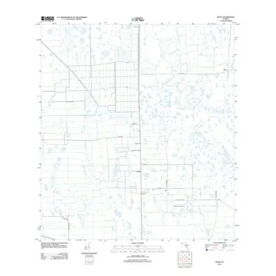
2012 Map of Felda
USGS Topo · Published 2012About this map
Felda and the small community of Keri anchor this region of Hendry County, defined by a distinct grid of agricultural land and managed hydrology. The landscape is characterized by its rural infrastructure, featuring private aviation facilities such as Duda Airstrip and Charlton Strip Airport that serve the local farming and ranching operations. Numerous family and local names are preserved in the road network, including Willis Ranch Rd, Morris Taylor Rd, and Neely Davis Rd, reflecting the generational footprint of land ownership in south-central Florida.
Find a feature on this map
18 named features on this map. Tap any name to fly to it.
Don’t see what you’re looking for? This feature index may not catch every label — zoom into the map to look around manually.
Map Details
Editions of this 2012 Felda Map
This is the sole edition of this map. No revisions or reprints were ever made.
Other maps of this area

1956 · West Palm Beach
USGS Topo · 1:250,000

1957 · West Palm Beach
USGS Topo · 1:250,000

1958 · West Palm Beach
USGS Topo · 1:250,000

1958 · Felda SE
USGS Topo · 1:24,000

1958 · Immokalee
USGS Topo · 1:24,000

1958 · Felda
USGS Topo · 1:24,000

1958 · Immokalee NE
USGS Topo · 1:24,000

1958 · Felda NE
USGS Topo · 1:24,000

1958 · Alva
USGS Topo · 1:24,000

1958 · Sears
USGS Topo · 1:24,000