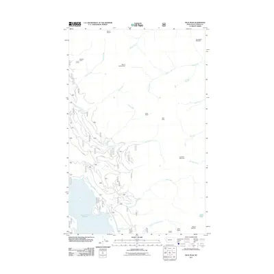
2011 Map of Felix Peak
USGS Topo · Published 2011About this map
Hungry Horse Reservoir dominates the southwestern corner of this landscape, its shoreline defined by the rugged topography of Flathead County. The terrain rises sharply toward the east, punctuated by prominent summits including Felix Peak, Mount Cameahwait, and Snowshed Mountain. This high-altitude region is heavily managed by the Forest Service, as evidenced by the network of forestry roads such as F S 2837 RD and the strategic placement of Canyon Lookout and Baptiste Lookout. A complex drainage system feeds into the reservoir and the South Fork Flathead River valley, with Harris Creek, Logan Creek, and Unawah Creek carving through the steep valleys. The map illustrates a wilderness shaped by modern water management and fire observation, where small glacial features like Cup Lake and Felix Basin remain preserved amidst the timber and rock of the northern Rockies.
Find a feature on this map
31 named features on this map. Tap any name to fly to it.
Don’t see what you’re looking for? This feature index may not catch every label — zoom into the map to look around manually.
Map Details
Editions of this 2011 Felix Peak Map
This is the sole edition of this map. No revisions or reprints were ever made.
Other maps of this area

1914 · Nyack
USGS Topo · 1:125,000

1958 · Circus Peak
USGS Topo · 1:24,000

1958 · Nimrod
USGS Topo · 1:24,000

1958 · Quintonkon
USGS Topo · 1:24,000

1958 · Felix Peak
USGS Topo · 1:24,000

1960 · Cut Bank
USGS Topo · 1:250,000

1963 · Cut Bank
USGS Topo · 1:250,000

1964 · Cut Bank
USGS Topo · 1:250,000

1964 · Essex
USGS Topo · 1:24,000

1964 · Pinnacle
USGS Topo · 1:24,000