
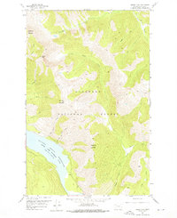
1958 Map of Circus Peak
USGS Topo · Published 1960About this map
Hungry Horse Reservoir dominates the southwest corner of this wilderness survey, reflecting a landscape transformed by the mid-century impoundment of the South Fork Flathead River. Situated within the Flathead National Forest, the terrain is defined by high alpine summits and a dense network of drainage basins. Notable peaks like Prospector Mountain and Circus Peak stand over a series of narrow valleys where Bergsicker Creek, Lower Twin Creek, and Tanner Creek flow toward the reservoir.
Find a feature on this map
20 named features on this map. Tap any name to fly to it.
Don’t see what you’re looking for? This feature index may not catch every label — zoom into the map to look around manually.
Map Details
Editions of this 1958 Circus Peak Map
2 editions found
Other maps of this area

1913 · Marias Pass
USGS Topo · 1:125,000

1914 · Nyack
USGS Topo · 1:125,000

1936 · Silvertip
USGS Topo · 1:96,000

1942 · Silvertip
USGS Topo · 1:125,000

1955 · Choteau
USGS Topo · 1:250,000

1957 · Choteau
USGS Topo · 1:250,000

1958 · Choteau
USGS Topo · 1:250,000

1958 · Nimrod
USGS Topo · 1:24,000

1958 · Quintonkon
USGS Topo · 1:24,000

1958 · Mount Bradley
USGS Topo · 1:24,000