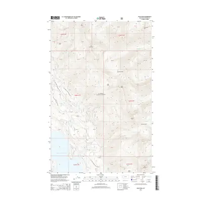
2014 Map of Felix Peak
USGS Topo · Published 2014About this map
Flathead National Forest encompasses this high-elevation wilderness within the Flathead Range, where vertical relief defines the geography of the northern Rockies. Significant summits including Felix Peak, Mt Baptiste, and Mt Adams overlook a network of glaciated valleys and drainages. To the southwest, the waters of the Hungry Horse Reservoir reach into the landscape, fed by the S Fork Logan Cr. The map details an environment primarily accessed by Forest Service infrastructure, such as Natl Forest Develop Road 1632 Rd and Natl Forest Develop Road 3811 Rd. This 2014 survey records the intricate drainages of Unawah Cr, Felix Cr, and Logan Cr, illustrating the complex hydrology that feeds the reservoir. Named points like Canyon Point and high-altitude features like Felix Basin and Silver Basin highlight the dramatic topographical shifts characteristic of this part of Montana.
Find a feature on this map
55 named features on this map. Tap any name to fly to it.
Don’t see what you’re looking for? This feature index may not catch every label — zoom into the map to look around manually.
Map Details
Editions of this 2014 Felix Peak Map
This is the sole edition of this map. No revisions or reprints were ever made.
Other maps of this area

1914 · Nyack
USGS Topo · 1:125,000

1958 · Circus Peak
USGS Topo · 1:24,000

1958 · Nimrod
USGS Topo · 1:24,000

1958 · Quintonkon
USGS Topo · 1:24,000

1958 · Felix Peak
USGS Topo · 1:24,000

1960 · Cut Bank
USGS Topo · 1:250,000

1963 · Cut Bank
USGS Topo · 1:250,000

1964 · Cut Bank
USGS Topo · 1:250,000

1964 · Essex
USGS Topo · 1:24,000

1964 · Pinnacle
USGS Topo · 1:24,000