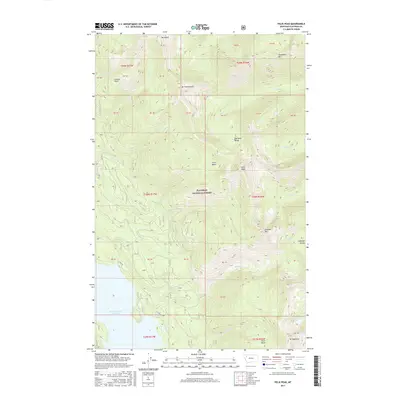
2017 Map of Felix Peak
USGS Topo · Published 2017About this map
The Flathead National Forest defines this high-altitude landscape in Flathead County, dominated by the peaks and drainages of the Flathead Range. The terrain is anchored by prominent summits including Felix Peak, Mt Baptiste, and Unawah Mtn, which overlook complex hydrological systems. Numerous creeks such as Java Creek, Sheep Creek, and Logan Creek carve through the mountains, feeding the prominent Hungry Horse Reservoir visible at the southwestern edge.
Find a feature on this map
34 named features on this map. Tap any name to fly to it.
Don’t see what you’re looking for? This feature index may not catch every label — zoom into the map to look around manually.
Map Details
Editions of this 2017 Felix Peak Map
This is the sole edition of this map. No revisions or reprints were ever made.
Other maps of this area

1914 · Nyack
USGS Topo · 1:125,000

1958 · Circus Peak
USGS Topo · 1:24,000

1958 · Nimrod
USGS Topo · 1:24,000

1958 · Quintonkon
USGS Topo · 1:24,000

1958 · Felix Peak
USGS Topo · 1:24,000

1960 · Cut Bank
USGS Topo · 1:250,000

1963 · Cut Bank
USGS Topo · 1:250,000

1964 · Cut Bank
USGS Topo · 1:250,000

1964 · Essex
USGS Topo · 1:24,000

1964 · Pinnacle
USGS Topo · 1:24,000