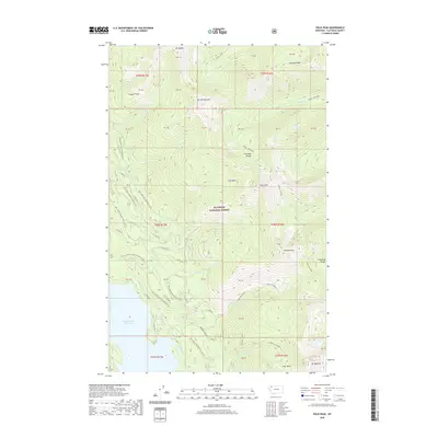
2020 Map of Felix Peak
USGS Topo · Published 2020About this map
Flathead National Forest encompasses this high-elevation landscape, where the Flathead Range forms a series of steep drainages and prominent summits. The southwestern corner of the map is defined by the shoreline of Hungry Horse Reservoir, a major water body fed by mountain streams such as Felix Creek and Dirtyface Creek. The terrain is marked by significant peaks, including Mt Adams, Felix Peak, and Snowshed Mtn, with Felix Basin and Silver Basin providing localized relief among the ridges.
Find a feature on this map
54 named features on this map. Tap any name to fly to it.
Don’t see what you’re looking for? This feature index may not catch every label — zoom into the map to look around manually.
Map Details
Editions of this 2020 Felix Peak Map
This is the sole edition of this map. No revisions or reprints were ever made.
Other maps of this area

1914 · Nyack
USGS Topo · 1:125,000

1958 · Circus Peak
USGS Topo · 1:24,000

1958 · Nimrod
USGS Topo · 1:24,000

1958 · Quintonkon
USGS Topo · 1:24,000

1958 · Felix Peak
USGS Topo · 1:24,000

1960 · Cut Bank
USGS Topo · 1:250,000

1963 · Cut Bank
USGS Topo · 1:250,000

1964 · Cut Bank
USGS Topo · 1:250,000

1964 · Essex
USGS Topo · 1:24,000

1964 · Pinnacle
USGS Topo · 1:24,000