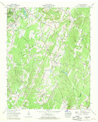
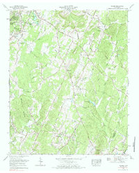
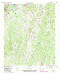
1967 Map of Felker
USGS Topo · Published 1970About this map
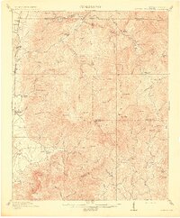
Million Hill and the Tennessee Valley Divide define the topography of this Bradley County landscape during the late 1960s. The area is characterized by a dense network of country churches and small family cemeteries, suggesting a deeply rooted rural community structure. Near the western edge, Waterville sits just south of the Sherwood Forest park area and unique minnow rearing pools, while the central valley contains several engineered water bodies like Jersey Meadow Lake and Green Shadow Lake. The settlement at Felker serves as a local crossroads amidst the drainage of Coahulla Creek and its many branches. This survey captures the transition from traditional agriculture to a more managed landscape, evidenced by the numerous named springs and churches like Samples Memorial Ch and Ladd Springs Ch that anchored these upland Tennessee communities.
Find a feature on this map
49 named features on this map. Tap any name to fly to it.
Don’t see what you’re looking for? This feature index may not catch every label — zoom into the map to look around manually.
Map Details
Editions of this 1967 Felker Map
3 editions found
Other maps of this area

1886 · Dalton
USGS Topo · 1:125,000

1886 · Cleveland
USGS Topo · 1:125,000

1892 · Cleveland
USGS Topo · 1:125,000

1892 · Dalton
USGS Topo · 1:125,000

1895 · Cleveland
USGS Topo · 1:125,000

1897 · Dalton
USGS Topo · 1:125,000

1901 · Cleveland
USGS Topo · 1:125,000
1911 · Cohutta Mtn
USGS Topo · 1:62,500
1913 · Cohutta Mtn.
USGS Topo · 1:62,500
1935 · East Cleveland
USGS Topo · 1:24,000