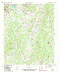
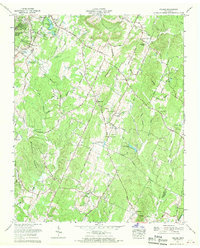
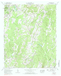
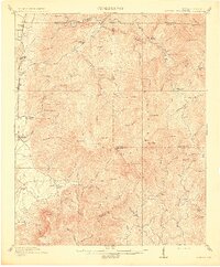
1967 Map of Felker
USGS Topo · Published 1990About this map
Sherwood Forest and Waterville sit along the western edge of this landscape, where residential clusters meet the undulating terrain of Blackburn Ridges. The map reveals a deeply rooted rural community defined by a high density of country churches and family-named landmarks, such as Thompson Springs Church, Moores Chapel, and Samples Memorial Ch. The Tennessee Valley Divide snakes through the center of the sheet, separating the drainages of Coahulla Creek and Chestuee Creek. These watercourses, alongside smaller tributaries like Hicks Creek and Wolf Creek, historically dictated the placement of early homesteads and cemeteries. Significant water features like Green Shadow Lake and Jersey Meadow Lake dot the valleys, while legacy infrastructure like the Taylor Sch and Valley View Sch reflect the mid-century social fabric of Bradley and Polk counties.
Find a feature on this map
53 named features on this map. Tap any name to fly to it.
Don’t see what you’re looking for? This feature index may not catch every label — zoom into the map to look around manually.
Map Details
Editions of this 1967 Felker Map
3 editions found
Other maps of this area

1886 · Dalton
USGS Topo · 1:125,000

1886 · Cleveland
USGS Topo · 1:125,000

1892 · Cleveland
USGS Topo · 1:125,000

1892 · Dalton
USGS Topo · 1:125,000

1895 · Cleveland
USGS Topo · 1:125,000

1897 · Dalton
USGS Topo · 1:125,000

1901 · Cleveland
USGS Topo · 1:125,000
1911 · Cohutta Mtn
USGS Topo · 1:62,500
1913 · Cohutta Mtn.
USGS Topo · 1:62,500
1935 · East Cleveland
USGS Topo · 1:24,000