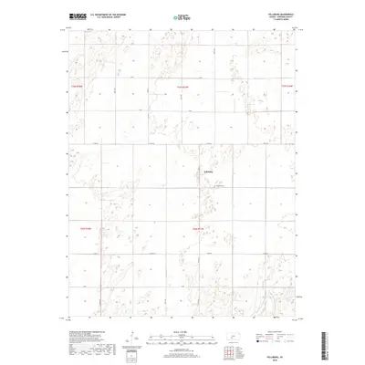
2018 Map of Fellsburg
USGS Topo · Published 2018About this map
Fellsburg serves as the primary focal point of this Edwards County landscape, a rural Kansas settlement defined by its grid of country roads and agricultural sections. The village is accompanied by the Fellsburg Cem just to its southeast, providing a vital point of interest for genealogists tracing local family history. The topography is dominated by the gentle drainage of Rattlesnake Cr, which meanders through the southeastern portion of the quadrangle. A precise network of section-line roads, including Co Rd 36 and Co Rd 42, divides the terrain into the traditional 640-acre blocks of the Public Land Survey System. This modern survey reflects the enduring structure of the Great Plains, where the orientation of farms and homes follows the strict cardinal lines established by early surveyors, centered around the townships of t25s r17w and t26s r17w.
Find a feature on this map
21 named features on this map. Tap any name to fly to it.
Don’t see what you’re looking for? This feature index may not catch every label — zoom into the map to look around manually.
Map Details
Editions of this 2018 Fellsburg Map
This is the sole edition of this map. No revisions or reprints were ever made.
Other maps of this area

1889 · Kinsley
USGS Topo · 1:125,000

1892 · Kinsley
USGS Topo · 1:125,000

1894 · Kinsley
USGS Topo · 1:125,000

1955 · Pratt
USGS Topo · 1:250,000

1959 · Pratt
USGS Topo · 1:250,000

1968 · Haviland NW
USGS Topo · 1:24,000

1968 · Haviland NE
USGS Topo · 1:24,000
1969 · Greensburg NE
USGS Topo · 1:24,000
1971 · Trousdale
USGS Topo · 1:24,000
1972 · Belpre
USGS Topo · 1:24,000